
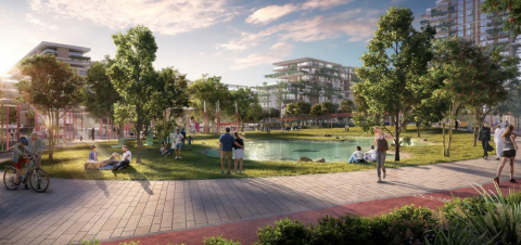
Meraas unveils plans for ‘Central Park’ neighbourhood at City Walk
Meraas has unveiled its plans for Central Park at City Walk, a new exclusive residential neighbourhood which will surround a 40,000 sqm private park in the heart of Dubai. As part of its dedication to create mould-breaking, imaginative ways of experiencing city life that inspire an active lifestyle for residents and visitors in sustainably-minded destinations, Meraas’ latest neighbourhood will redefine community living in the emirate.